Blue Canyon Technologies small satellite platforms play an essential role in weather research and monitoring

Approximately 16 million storms occur around the world each year. The United States alone has sustained 403 weather disasters since 1980 where overall damage / cost reached or exceeded $1 billion, with the total cost of these events exceeding $2.915 trillion. Trends indicate that the number of such events is increasing over time, creating a worldwide need for understanding and predicting severe weather. Small satellites are helping to meet these needs in a variety of ways.
Unparalleled Data Collection
There are many ways to gather weather data, including ground-based radars, weather balloons, field campaign work and citizen science collections. However, these measurements lack two specific characteristics that can only be provided by satellite measurements from space – global coverage and statistically significant datasets by virtue of the large amounts of data collected.
While field observation data is prevalent in more populated areas of the United States, satellites are the only source of information in low-density areas or those with complex terrain. These gaps can lead to inaccuracies in forecasting severe weather and flash floods, as well as missed warnings for wildfire ignition.
On a global scale, there are few ground observations in areas like Africa and South America. Weather measurements captured from space help scientists like Dr. Kristen Rasmussen, researcher and associate professor of atmospheric science at Colorado State University, understand not only what is happening on these continents and other remote regions but also provide a more accurate picture of the worldwide weather landscape.
“Satellites have revolutionized our understanding of the nature of convection and weather globally, in particularly in remote areas that don’t have observations,” said Dr. Rasmussen “The more we understand the whole globe, the more we understand what’s happening in our own country.”
In addition, with a planet that is two thirds water, having satellite observed weather data over the world’s oceans is critical to improving forecasting models and initializing forecasts. Small satellite networks help fill gaps by providing real-time monitoring of storm development far from land.
“In hurricane forecasting, we need continuous data inputs to keep our models running, particularly observations off the United States and from the mid-Atlantic, which we are unable to capture through weather balloons or ground radar,” said Rasmussen. “Our forecast models benefit from the assimilation of high-quality observations across the world, especially in remote areas, and it is fundamentally imperative that we have observational input from all regions around the planet.”
The pervasive global coverage provided by weather satellites allows us to determine statistically significant relationships between storm intensity and their environments, thereby complementing and validating field campaign observations.
More Frequent Observations Lead to Near-Continuous Monitoring
Traditional weather satellites in geostationary orbit provide continuous views of the same region on Earth. While their continuous observations provide extremely valuable observations of the development of storms, their passive instruments do not provide insights inside storms.
On the other hand, active instruments carried by smallsats traveling in low-Earth orbit can “peer inside” thunderstorms, giving us valuable insights into the processes driving severe weather systems.
For example, NASA and MIT’S Lincoln Laboratory’s TROPICS (Time-Resolved Observations of Precipitation structure and storm Intensity with a Constellation of Smallsats) mission comprised of a constellation of four CubeSats observes the inner workings of tropical storms six times more quickly than in the past. TROPICS CubeSats built and flown by Blue Canyon are monitoring the formation and evolution of storms in the Earth’s tropics regions approximately once an hour, while previous monitoring capabilities can only operate in six-hour intervals.
Constellation Capabilities
The TROPICS mission demonstrates how deploying constellations of small satellites can overcome the limitations of single, large satellites by providing comprehensive and rapidly evolving coverage.
In addition, smallsat constellations provide rapid, successive sampling of the same storm system allowing researchers to observe how storms evolve in time. Combining the observations from geostationary and earth-orbiting satellites provide unprecedented views of storm structure, evolution and intensity.
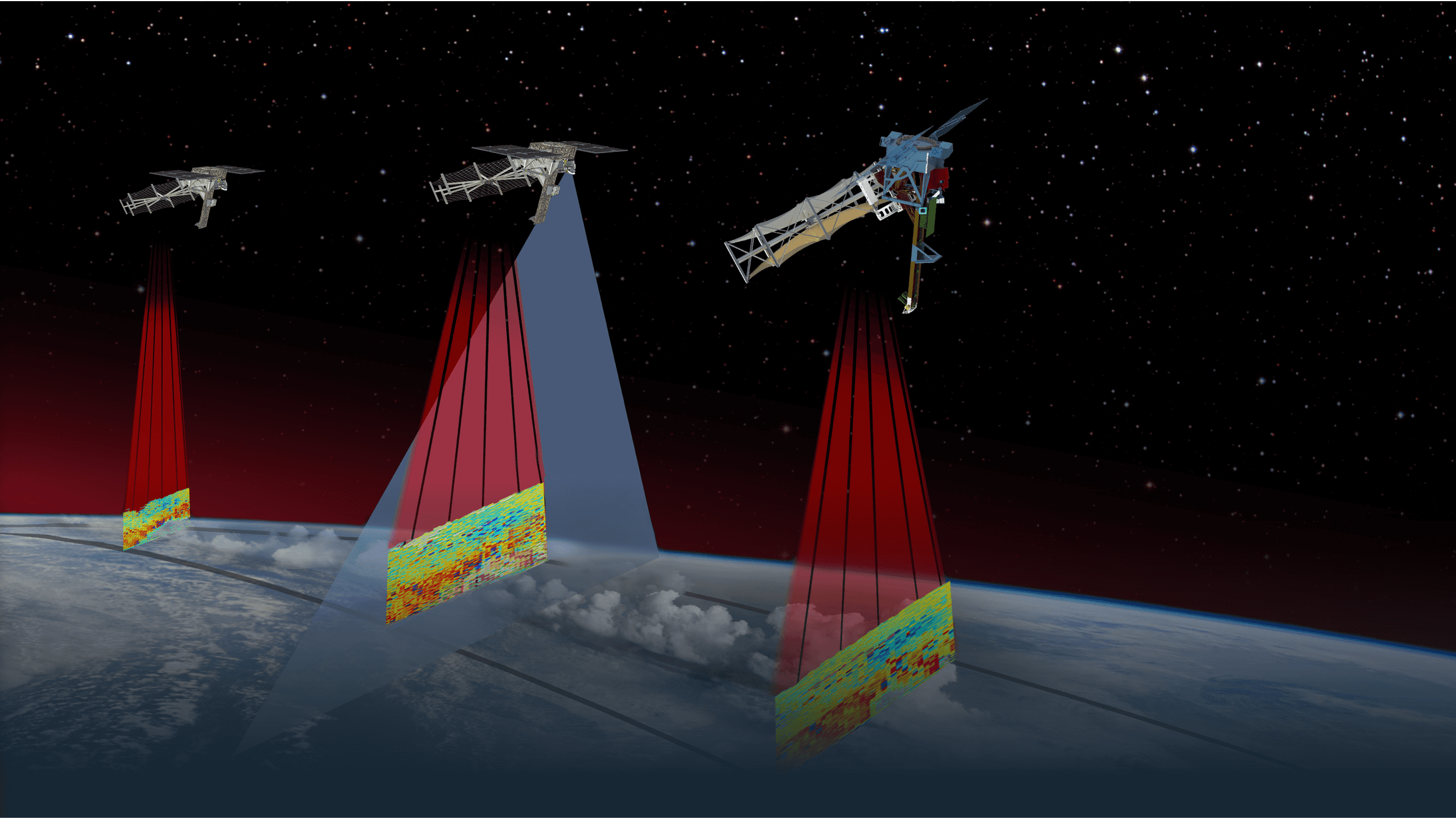
As part of NASA and Colorado State’s upcoming INCUS mission, three of Blue Canyon’s Venus-100 buses will fly in a staggered train – two closer together and one further behind, providing observations at 30-second, 90-second and 120-second intervals – to measure short-term and longer-term changes in thunderstorms, providing insights into both moderate and more intense upward motions and hence storm severity.
“Smallsat constellations provide enormous observational datasets at lower costs and shorter production times than the larger, traditional flagship missions,” said Dr. Susan van den Heever, distinguished university professor in the department of atmospheric science at Colorado State University and principal investigator for the INCUS mission. “Storms are very dynamic. The upward moving air in storms changes very rapidly, so being able to fly smallsat trains that can capture more than just a single measurement is really critical in observing storm evolution.”
Advanced Monitoring Technologies
Each INCUS spacecraft will carry a seven-beam scanning Ka-band radar with RainCube heritage and a radiometer with cross-track scanning capabilities, developed by NASA’s Jet Propulsion Laboratory. The INCUS payload is an example of how co-located advanced sensors and other tools can capture higher spatial and temporal resolution imagery and atmospheric data, thus improving short-term forecasting and early warnings for hurricanes, tornadoes and thunderstorms.
The INCUS mission will investigate the vertical transport of air and moisture – called convective mass flux – within storms in the tropics and subtropics. The
greater the convective mass flux, the larger the risk of extreme weather conditions. The physics controlling the convective mass flux phenomenon remain unclear. INCUS will make the first ever systematic observations of convective mass flux and its evolution in space and time. Only through the development of the INCUS mission will scientists have new insights into the dynamic nature of clouds and rain.
Extreme Weather Alerts
The advanced monitoring systems provided by small satellites are also imperative to the preservation of life and property in instances of extreme weather.
“The global observations of convective mass flux made by the INCUS constellation of smallsats will provide unprecedented insights into how the environments in which storms develop determine their ability to produce large hail, flood-producing rainfall and tornadoes. These observations will also strengthen our weather prediction models and hence severe storm predictions” said van den Heever.
Serving Future Populations
Blue Canyon Technologies’ low-jitter bus platforms offer advanced pointing capabilities that are trusted by the weather monitoring industry. Not only do these spacecraft provide crucial updates to emergency responders, allowing for better preparedness and faster evacuation planning, but they also help us understand what the future might hold for our country and planet.
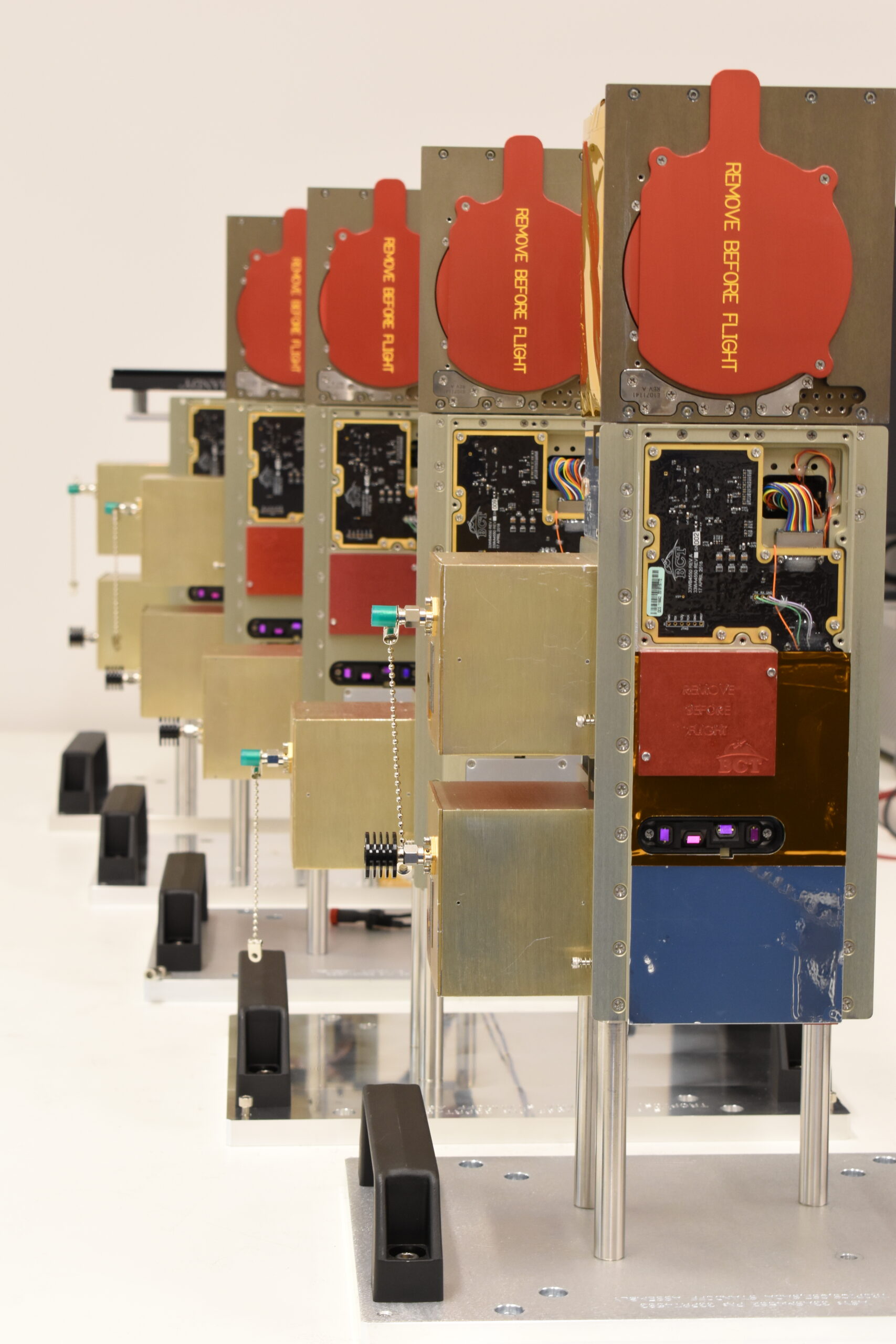
Blue Canyon Technologies has nearly a decade of heritage with weather missions, beginning with its first spacecraft, the Radiometer Assessment using Vertically Aligned Nanotubes (RAVAN) CubeSat. RAVAN launched in 2016 to measure the difference between the amount of energy from the Sun that reaches Earth and the amount that is reflected and emitted back into space. RAVAN, along with TEMPEST-D and TROPICS, are part Blue Canyon’s portfolio of 25 spacecraft that have launched in support of weather research and monitoring. The three INCUS buses are part of another 16 weather spacecraft built by Blue Canyon currently in production or awaiting launch.
The increasing frequency and severity of extreme weather events highlight the urgent need for improved monitoring and forecasting capabilities. Small satellites, with unparalleled data collection, rapid monitoring and advanced sensing technologies, are transforming our ability to track and predict severe weather in real time. Blue Canyon Technologies is a key player in this movement, providing critical data for weather research, emergency response and long-term environmental planning. As satellite constellations continue to expand and evolve, we will continue to play an essential role in enhancing global resilience against weather events.